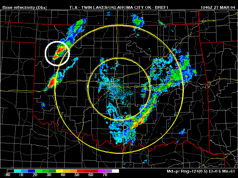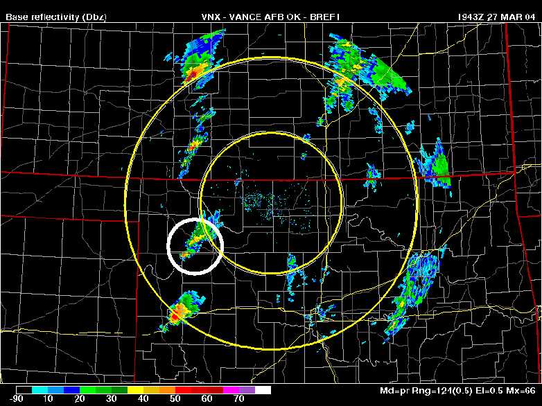
Viewing a storm with multiple radar perspectives
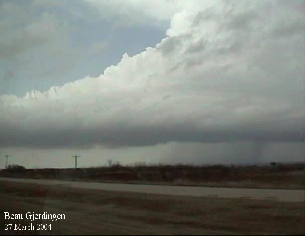
A supercell being chased in Northwest Oklahoma on 27 March 2004 by Beau Gjerdingen
and others
was a tornado warned storm and said to be very well organized. The nearest radar
(Vance AFB), however,
was indicating the cell as a moderate thundershower with approximately 40dBZ
reflectivity. The storm was
only about 50 miles southwest of the radar site at this time. When they looked
at the Oklahoma City reflectivity
at nearly the exact time, the cell was on the outside northwest fringes of that
radar's range and was at
over 60dBZ of reflectivity.
In this case we're looking at 0.5° elevation radar slices and the radar
site closest to the storm is looking lower
into the storm than the radar further from the storm. This is simple trigonometry.
Due to the intense updraft
of a pending severe storm, precipitation sized particles initially remain suspended
aloft rather than falling to the
surface which is why the storm looks more intense
when viewed from the radar furthest away.
This feature, often referred to as "echo overhang", could also be
replicated by comparing the 0.5° slice to
higher elevation slices. It is a good indication of what is to come since, afterall,
what goes up will eventually come
down. This same feature was intially evident for the 22 June 2003 Aurora, NE
record hail storm. I was able to
drive right under the updraft to get in position without so much as a drop of
precipitation.
Refer to the saved radar images below (courtesy of Beau Gjerdingen). The storm
of discussion is circled in white.
Click on image for larger size..