Radar Images of Past Storms
Below are radar images of storms I saved while sitting at home
wishing I was watching them first hand.
Click images to enlarge.
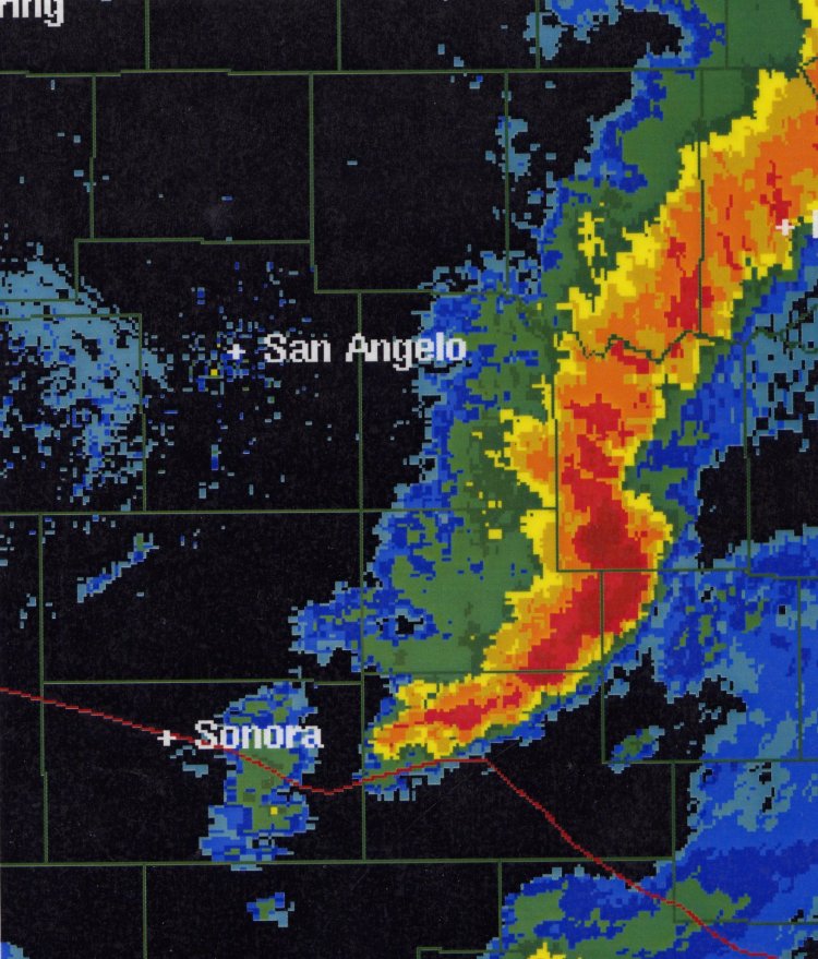
Left: Radar image from San Angelo of squall line with bow echo and embedded
supercells (4:30 pm; 4/7/02).
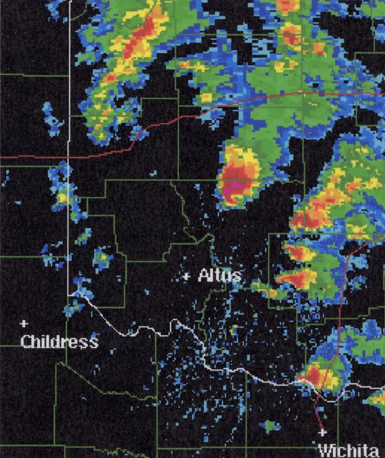
Right: Radar image from Freederick, OK containing a supercell well defined hook
echo (3:00 pm; 3/17/03).
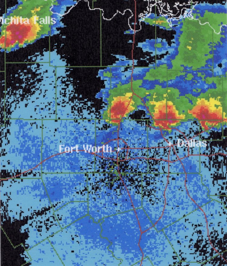
Left: Radar image from Dallas/Fort Worth conaining three supercells all with
well defined hook echoes (9:20 pm; 4/5/03)
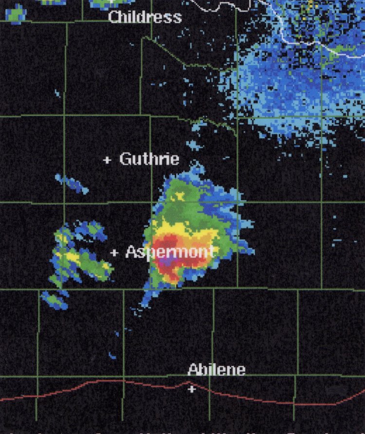
Right: Radar image from Frederick, OK containing a supercell with a well defined
hook echo (5:08 pm; 4/5/03).
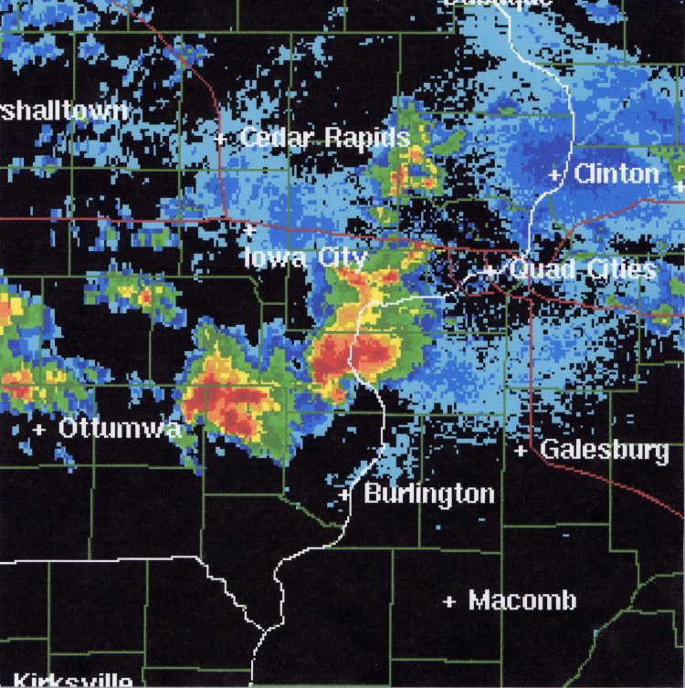
Left: Radar image from the Quad Cities containing two supercells with well
defined hook echoes (5:00 pm; 4/30/03).
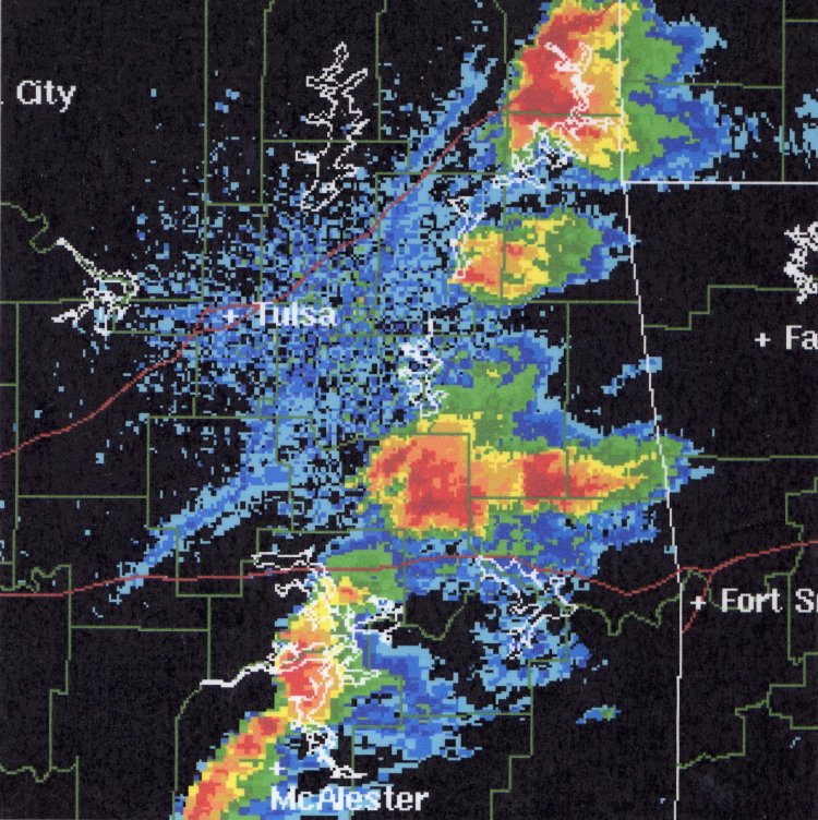
Right: Radar image from Tulsa, OK containing a squall line with embedded supercells
( 6:25 pm; 5/6/03).