Left: Looking north near the US 2 and US 18 interestion at 6:26 pm. Right: Looking at nice structure southwest toward Larimore on CR 11 at 6:39pm.
Larimore, ND Tornado- June 26, 2009
I was anticipating this chase day for as long as a week based on relatively consistent GFS output. A couple days out my confidence grew in a chaseworthy setup and I was quite anxious to chase given this was the first solid setup of the season for northeast North Dakota. The SPC was hesitant a couple days out and only went with a "SEE TEXT". The SWODY1 would later upgrade to SLIGHT and this forecast seemingly verified well. I was at work through 4pm and was monitoring the situation during the afternoon. A low level theta-e boundary was evident southwest of Grand Forks on the surface map. A secondary boundary was approaching from the west and the two boundaries intersected near Devils Lake mid to late afternoon. Storms bagan to pop late in my shift and I went home to keep tabs on the situation. I was not in a rush to leave given the close proximity of the storms. I finally decided to leave around 5:30 but failed miserably to plan ahead as I needed to get fuel and batteries for the weather radio. After a five minute delay I was westbound on U.S. 2 with a destination of Michigan, ND. I never made it to the town as a wall of green clouds approached Larimore. The weather radio was blurting out a couple of tornado warnings in relatively short proximity so I briefly parked at a rest area at the junction of 2 and 18 to evaluate my options. I opted to turn north on U.S. 18 and then decided to go east on County 11 as the northern option looked trecherous. I made the right move as I must have found the only hill in the Red River Valley a couple miles east to perch. I snapped a few photos of the green clouds to the north and approaching mess to the west. The NWR continued to blurt tornado warnings including one about five miles to my southwest. I was skeptical given the "shelfish" look to the storm but I failed to consider I was not experiencing any outflow. I snapped several pictures on the hill over the course of a few minutes and noticed a lot of dust getting fed to the sky to my southwest. I did not recognize a tornado at the time but a look at my photos and radar archive combined with a tornado report in the same location, led me to believe with a fair amount of confidence I did observe a tornado. Further, a decent tornado was observed near the town of Michican earlier in the storm cycle (Perhaps I should have departed to my target area sooner!)*. Since I was on a gravel road I wanted to get east before the heavy rain and potential hail hit. I managed to stay dry until fiinding pavement just north of the air force base. I was heading south toward U.S. 2 but unfortunately another driver was riding my bumper. What I assume was a gustnado hit the base and bagan to cross the road just ahead of me. I could not slow down too fast as I did not want to be squashed by a Chevy truck. Instead, I enjoyed a plume of rotating debris smacking my car. Fortunately this was mostly small vegetation debris and all was calm within a few seconds. Moments later I parked near the town of Emerado to watch dust clouds to the north and west. Not seeing anything in the way of tornadic activity I opted to make the short 10 mile voyage home. I was quite skeptical of various spotter reports in the Grand Forks area but several meteorologists did see a funnel cloud just west of town. This seemed unusual given my place on the west end of the city was getting hammered with 50-60 mph outflow winds at the time. This was a tough storm for readily identifying features. * A few folks remain skeptical the feature I observed was a tornado. Friendly scientific debate is always encouraged and since my self-esteem is not related to my tornado count I will not be offended by differing opinions. At the end of the day I enjoyed a heck of a storm. Click images for larger size. |
|
Left: Looking north near the US 2 and US 18 interestion at 6:26 pm. Right: Looking at nice structure southwest toward Larimore on CR 11 at 6:39pm. |
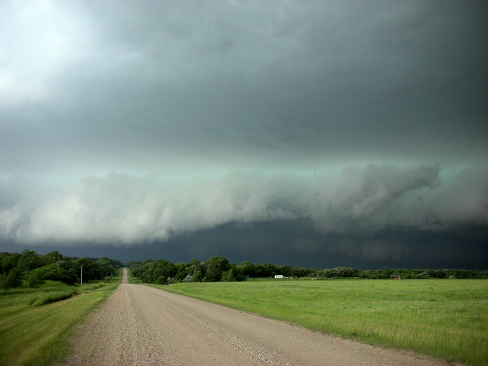
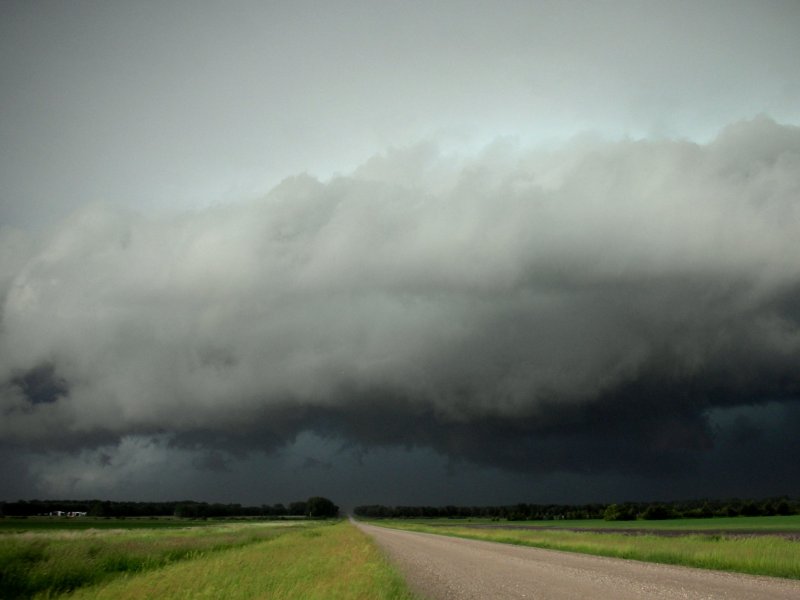
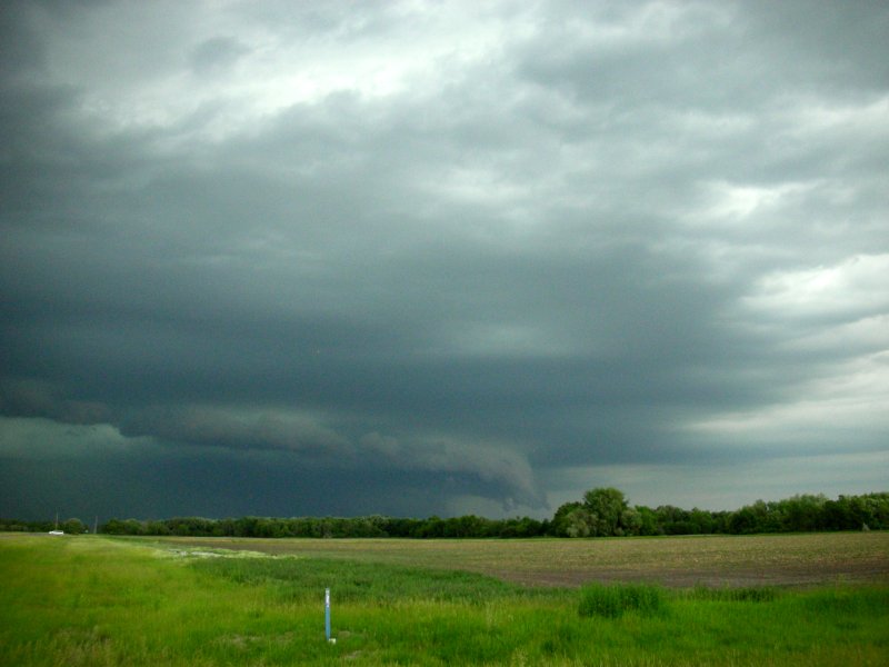
Left: Looking west on CR 11 a couple miles east of US 18 at 6:32 pm. Right: Same location at 6:38 pm. |
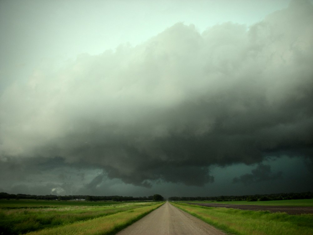
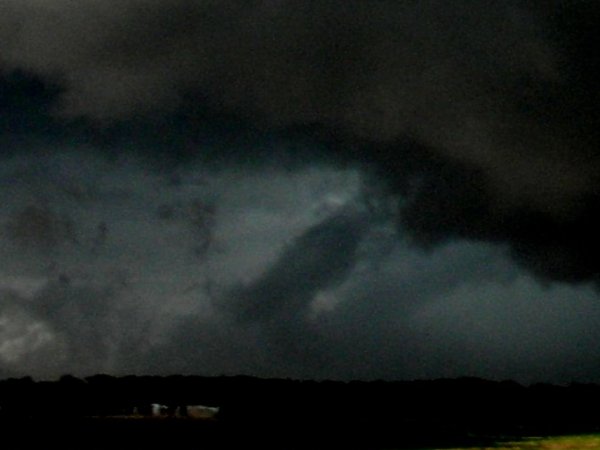
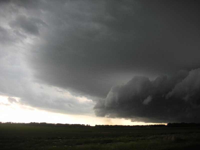
Left: Same location as above at 6:40 pm with apparent tornado to my southwest.. Right: Contrast adjusted zoomed image of apparent tornado. Tornado estimated to be 4 NNW of Larimore which would coincide with a report 3 NW Larimore. |