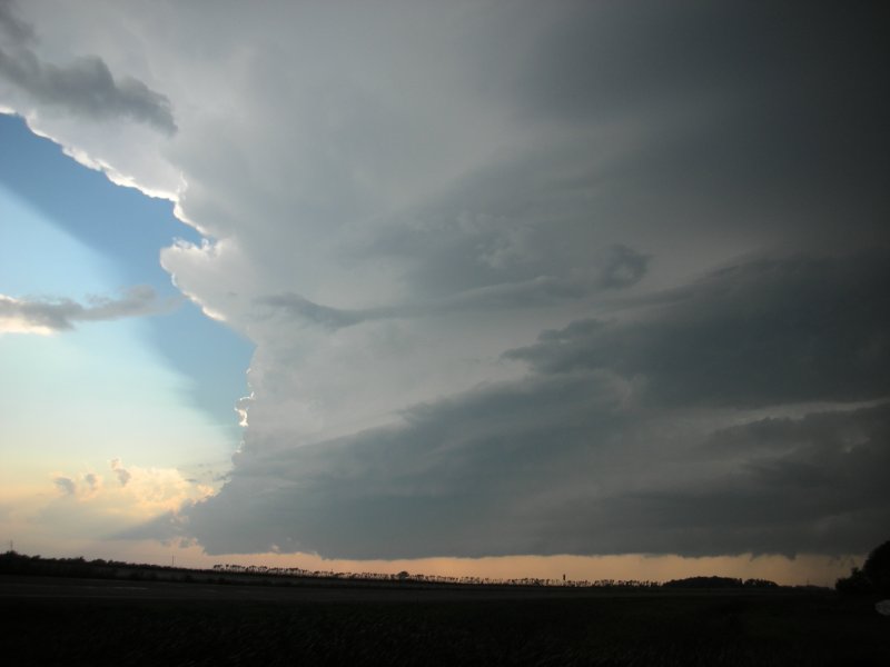
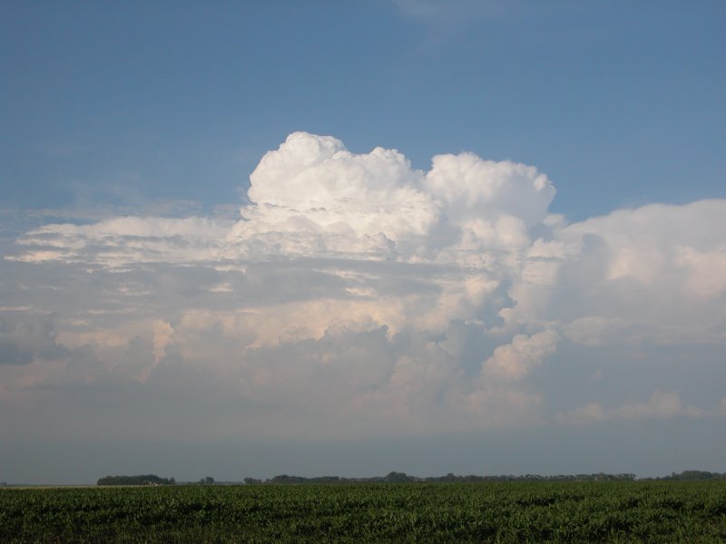
Updraft region of supercell near Petersburg.
Petersburg - Northwood, ND - Aug 26, 2007
Who wants to go to Fire Lake?...
| A couple of NAM model runs suggesting a hightly sheared unstable environment for the evening hours in northeast North Dakota. There was some concern for cap as well as a persistent dry pattern which made me skeptical there would be a sudden deluge. Late in the afternoon storms were beginning to fire and the SPC had a tornado watch in effect. A look at some mesoanalysis graphic indeed suggested many variables were in place for supercell thunderstorms and tornadoes. I left home around 6:30 but had to get some gasoline in the car before wandering too far. I told myself to do this the day before just in case. I had three supercell thunderstorms to chase. Do I go northwest, west, or southwest. The western cell looked better visually and was the easiest to drive toward. I took the four lane U.S. Hwy 2 west and stopped in and around the town of Petersburg to snap some photos of the very nice looking storm. While I was watching the storm a tornado warning was issued for the northern cell but I elected not to go after it as visibility looked poor. I decided to go back east a bit and get more ahead of the cell I was watching. The storm did tighten up a bit but it was apparent the storm was not going to generate a tornado anytime soon. While at the intersection of U.S. 2 and U.S. 18 I heard either a severe storm or tornado warning for southwest Grand Forks County on the NWR (NOAA Weather Radio). I wasn't too far from their so south on U.S. 18 was a go. What I failed to realize was the cell was much larger and closer than I expected. The drive down 18 was a mess of heavy rain and occasional hail in the forward flank of the supercell. The NWR stated a tornado was observed 10W of Northwood when I was just a few miles north of Northwood. When I made it to the interestion of U.S. 18 and ND 15 I really wasn't sure what to do. I thought of driving to Northwood and watch the storm there. I ended up decideing to drive a mile west on 15 and find a place to park off the road. It wasn't long before I saw a funnel develop to my southwest. I took a series of low light, poor visibility photos of the feature through the windshield since it was raining steadily and lightning made leaving the vehicle hazardous. The last photo I took of the funnel was at 8:27. (Some discussion on what I saw and what later transpired in Northwood is found embedded within the photos below). I was getting quite uncomfortable being I was due east of a potential tornado and daylight was quickly fading. Without the aid of onboard radar data I had no choice but to call it quits. It didn't hurt that my wife was anxious for me to get home. On that note I headed east on 15 passing the north side of Northwood between 8:35 and 8:40, about 10 minutes before an EF4 rated tornado ripped the town apart. The drive down 15 was nothing short of a hellish journey consisting of blinding continuous cloud to ground lightning, heavy rain, and hydoplane action. I heard a note on the scanner about Northwood getting hit by a tornado when I was about 10 miles east of there and was actually glad I didn't see one for a change. Coincidentally my wife and I actually considered purchasing a house in that town before opting to live just down the steet from work. Now I will never second guess that choice. I arived home in Grand Forks around 9:10 after battling heavy rain on I-29. The barrage of lightning was relentless and perhaps the wildest show I have ever witnessed. A few pieces of dime to nickel sized hail plunked the house but the bulk of the storm was over by 10pm. Tremendous lightning contininued into the night but I had to head to work for the night shift. While on shift I noticed some of the hi-res radar grabs posted on the Eastern US Wx Forum and only then did I realize the precarious position I was in while sitting near the 18-15 intersection. Many storm chasers would be upset about missing the opportunity to see an EF4 tornado in action but given my initial position was quite happy to have gotten out of trouble unscathed. Aaron Kennedy was able to capture an image of the tornado but it was completely wrapped in rain which only further showed how dangerous the situation was for storm spotters and chasers alike. I remember seeing two storm spotters on the north end of Northwood. Thankfully the tornado went east of their location had they not been able to bail beforehand. Sadly, one person died in the storm but as one often hears, the situation could have been far worse had the tornado been at its peak intensity in the residential area of town. (Click images to enlarge) |
|
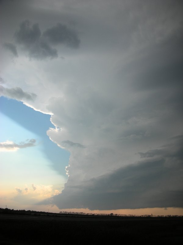
Updraft region of supercell near Petersburg.
|
|
Left: verticle image of storm near Petersburg. Right: same storm viewed a bit later and further east. |
|
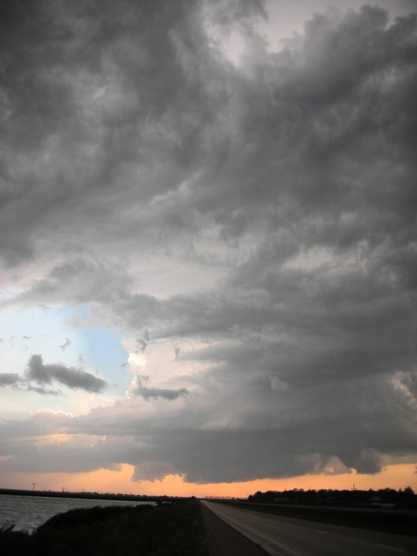
Storm viewed from near Niagra appears to tighten up a bit.
|
|
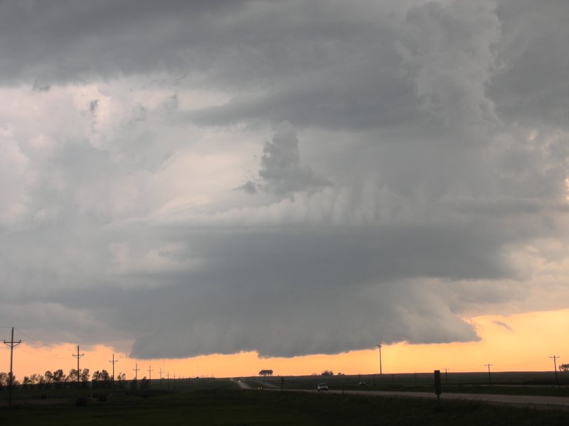
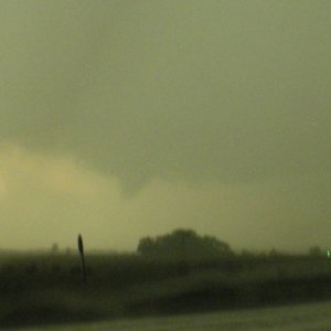
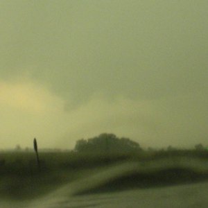
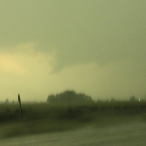
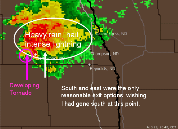
Funnel develops a few miles west of Northwood. Last image at 8:27 then the feature either disipates or becomes rainwrapped; time to bail just to be safe. |
|
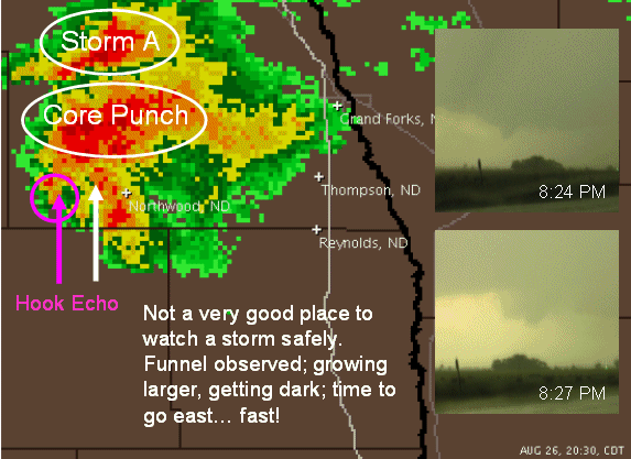
Top: Radar image at 8:30, about the time I leave my spot just west of Northwood. My estimated position at the time indicated by the white arrow. The Petersburg storm is labelled A. After departing that storm I punched the core of the Northwood storm only to end up in a hook appendage of the storm. This is one reason why punching a core isn't the best idea if you do not have radar in the chase vehicle or a real good nowcaster. I had neither. The thumbnail images of the funnel to my southwest were taken at 8:24 and 8:27. I don't know if the funnel I photographed was from the mesocyclone that produced the Northwood tornado or was from a decaying one. Some archived velocity images may shed some light. All I knew was it was time to go east and fast as I was in or near the path of something nasty. Middle: Radar image at 8:40. My estimated position indicated by the white arrow. At this time I believe I was a few miles east of Northwood little knowing what would happen minutes later. The appendage on radar over Northwood at this time is not the menace to arrive moments later.
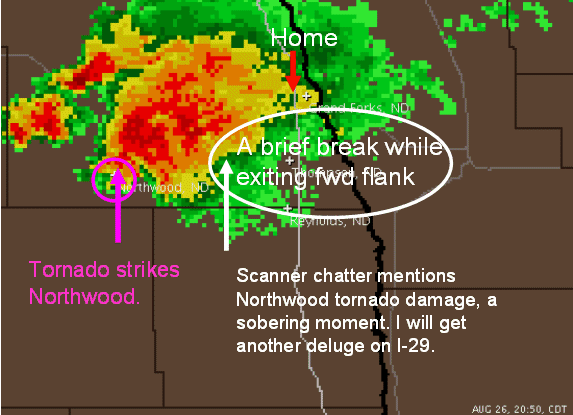
Bottom: Radar image at 8:50, the time a powerful tornado is tearing through Northwood. My estimated position indicated by the white arrow. I was about ready to get a brief respid from the heavy rain. More heavy rain awaits when I puch north on I-29. |
More radar images pending.

