May 5, 2004 Lincoln, Nebraska Heat Burst (Non-Chase Event)
A
heat burst associated with collapsing thunderstorms hit Lincoln at about
10:35 PM. The temperature surged from 82°F
at 10:19 pm to 90°F at 10:35 pm. The peak temperature associated with
the late evening heat burst was the daily high temperature for Lincoln. Also of note is the dramatic dewpoint drop. It
sank from 58°F before the event to 41°F at the
height of the event. The temperature spike was associated with a recorded
60 knot wind (upwards of 70 MPH) gust which
was induced by collapsing thunderstorms bringing high theta air to the
surface. Numerous wind damage reports were
associated with the fading storms and the NWS had to issue a high wind
warning for the area. I was hoping the outflow was
going to cool my place off after a rather warm day but instead was greeted
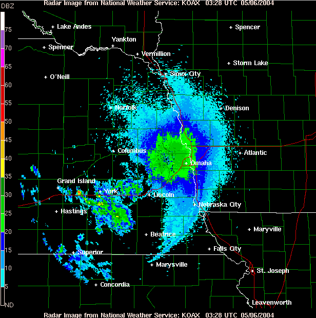
with hot dry air. Attached is a radar image near
the time of the burst. Note the well defined outflow boundary southeast
of Lincoln. |
FIG. 1 OAX radar image at 0328 UTC (10:28 pm), just a few minutes prior to the heat burst in Lincoln.
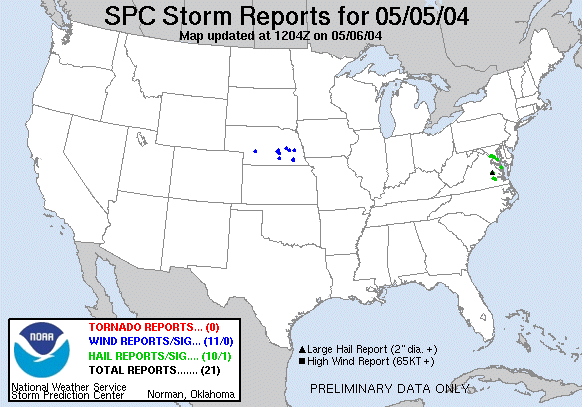
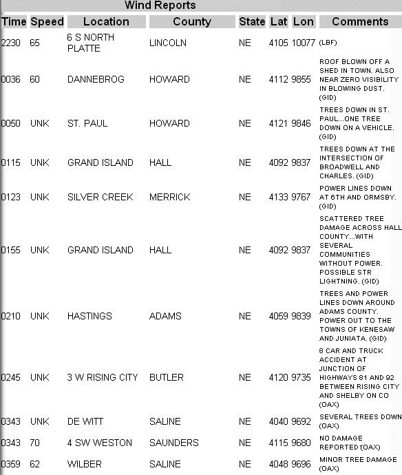
FIG 2. SPC Wind Reports from May 5, 2004. The 60 knot wind
gust at the Lincoln airport is not indicted here.